The roar of jet engines and the bustle of terminal lobbies contradict the intricate digital choreography behind every modern airport. In the early days, architects and engineers relied on 2D drawings, paper blueprints, and segregated teams to design runways, terminals, and support facilities.
But today, airports are living ecosystems, complex networks of structural, mechanical, electrical, and operational systems that must interoperate flawlessly. Enter Building Information Modeling (BIM): a data‑driven approach that transforms static drawings into rich, collaborative 3D models enriched with time (4D), cost (5D), and performance analytics.
Why does this matter? For industry professionals, architects, engineers, contractors, and airport authorities, BIM unlocks unprecedented clarity. It streamlines coordination across multiple disciplines, automates clash detection, and optimizes construction sequencing to shave months off schedules and millions off budgets. For newcomers, it offers intuitive visualization and simulation tools that declutter complex designs, ensuring stakeholders at every level can engage meaningfully.
1. BIM Fundamentals in Airport Development
1.1 From 2D to 3D: The Evolution of Airport Design
Building Information Modeling replaces conventional 2D plans with a unified 3D model that encompasses geometry, spatial relationships, and rich metadata. Rather than static drawings, stakeholders access a living model where structural frames, HVAC ducts, electrical conduits, and plumbing networks coexist in a single environment.
This paradigm shift reduces misinterpretation, manual rework, and design clashes critical for large‑scale airports featuring miles of taxiways, expansive terminals, and complex baggage systems.
1.2 4D & 5D Extensions: Scheduling and Cost Analytics
Beyond geometry, BIM integrates scheduling (4D) and cost estimation (5D). Project teams link construction tasks to model elements, generating time‑lapse simulations that visualize sequencing and reveal potential bottlenecks long before ground is broken.
Cost data attached to quantities of materials and labor rates enables dynamic budget tracking, empowering decision‑makers to evaluate “what‑if” scenarios for phasing or value engineering.
1.3 Clash Detection and Coordination
In airports, where MEP (mechanical, electrical, plumbing) systems can crisscross structural elements, clash detection is indispensable.
BIM platforms automatically flag interferences such as a duct penetrating a steel beam allowing design teams to resolve conflicts virtually rather than during construction, where corrections are exponentially more expensive.
2. Advanced Integrations for Smarter Airports
2.1 BIM + IoT = Proactive Maintenance
United BIM highlights that coupling BIM with IoT sensors transforms 3D models into real‑time operational hubs. Embedded sensors feed performance data like temperature, vibration, energy consumption into the BIM environment, enabling facility managers to monitor equipment health and schedule preventative maintenance before failures occur.
2.2 GIS for Climate Change Resilience
Integrating Geographic Information Systems (GIS) with BIM enriches airport models with terrain, hydrology, and climate‑projection data. GIS for climate change adaptation allows planners to simulate flooding scenarios, wind patterns, and heat islands, informing resilient runway elevations, drainage designs, and material selections.
For example, Pittsburgh International Airport’s adoption of GIS‑BIM digital twins helped the airport map flood‑risk zones and optimize stormwater infrastructure to mitigate climate threats.
2.3 AI & Machine Learning in Design Automation
Autodesk’s “BIM for Smart Airports” webinar underscores AI and machine learning’s potential to automate repetitive tasks such as generating parametric runway geometry or optimizing mechanical layouts thereby accelerating design cycles and reducing human error.
AI‑driven generative design can propose multiple terminal layouts that balance passenger flow, security checkpoints, and retail areas based on predefined performance criteria.
2.4 Digital Twin Technology
Digital Twins are dynamic, data‑rich replicas of physical infrastructure. When BIM models are connected to live data streams IoT, GIS, CCTV they become virtual twins capable of simulating operational scenarios, forecasting traffic peaks, or training emergency responders. This continuous feedback loop enhances situational awareness and long‑term asset optimization.
3. Real‑World Case Studies
3.1 Changi Airport (Singapore): Reality Capture for Rapid Modeling

Using reality‑capture technologies, Changi Airport constructed a detailed 3D BIM model 40% faster than traditional methods.
High‑resolution laser scans of existing terminals were registered, meshed, and converted into intelligent BIM objects accelerating retrofit projects and minimizing downtime.
3.2 Denver International Airport (DEN): South Terminal Redevelopment
For DEN’s South Terminal Redevelopment, BIM was pivotal in coordinating over 120 subcontractors across complex scheduling, clash detection, and resource management tasks.
The result: a 20% reduction in project duration and significant cost savings through early issue resolution and data‑driven forecasting.
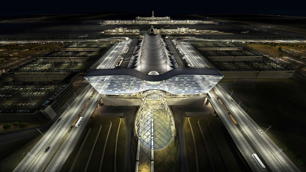
3.3 Abu Dhabi International Airport Expansion (Midfield Terminal)
Although detailed figures are proprietary, industry reports note that BIM‑enabled workflows streamlined Abu Dhabi’s Midfield Terminal complex by facilitating real‑time design validation, MEP coordination, and material take‑off, helping the project adhere to strict deadlines amid challenging desert conditions.
3.4 Chennai International Airport: Overcoming Execution Challenges
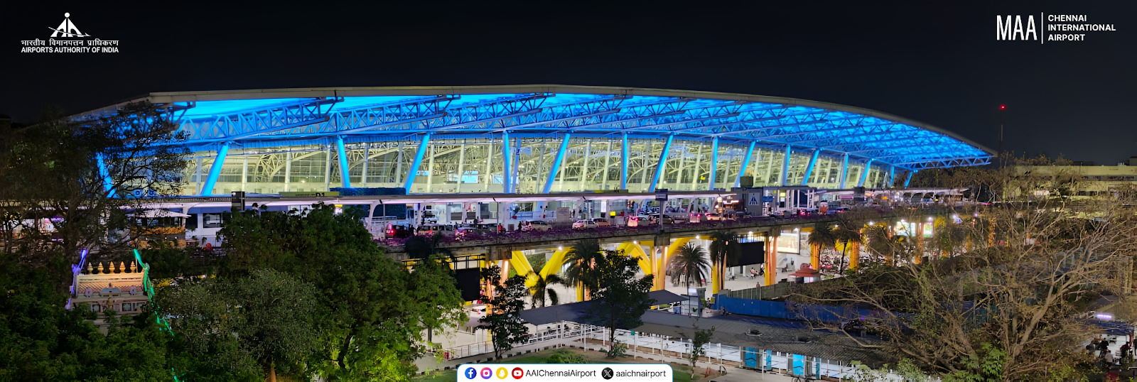
A 2013 IJERT study of Chennai Airport found BIM’s 4D simulations critical for visualizing truss erection workflows, optimizing crane placements, and mitigating underground utility clashes, directly addressing delays caused by unforeseen rock strata and congested reinforcement detailing.
3.5 Pittsburgh International Airport: GIS‑BIM for Sustainability

Pittsburgh’s GIS‑BIM integration extended beyond design: the airport deployed GIS apps for fire‑suppression asset tracking, turf‑maintenance boundaries, and pollution‑monitoring stations.
These spatial‑analytical tools, built on a BIM backbone, enhanced operational resilience and supported climate‑change monitoring initiatives.
4. Key BIM Tools, Plugins, and Resources
- Autodesk Revit & Civil 3D: Industry‑leading platforms for parametric modeling, clash detection, and grading design.
- Navisworks: Comprehensive coordination environment for model aggregation, scheduling simulation, and 4D animation.
- Bentley OpenBuildings Designer: Integrated architectural and structural workflows with robust analysis tools.
- Esri ArcGIS Pro: GIS powerhouse for geospatial data management, climate‑scenario mapping, and integration with BIM via ArcGIS BIM‑GIS Connectors.
- Tekla Structures: Advanced steel and concrete modeling, used notably in India’s Chennai Airport project.
- Open BIM Standards (IFC, ISO 19650): Ensure interoperability across tools and stakeholders, mandated in many global airport projects.
- AI‑Powered Plugins (e.g., Autodesk Generative Design, Dynamo): Automate layout optimization and data‑driven decision‑making.
5. Best Practices and Frameworks
- Adopt a Common Data Environment (CDE): Centralize all project information: models, documents, schedules, in a secure and accessible platform.
- Implement PAS (Problem‑Agitation‑Solution) for Stakeholder Buy‑In: Clearly articulate project challenges, underscore risks of traditional methods, and demonstrate BIM’s ROI.
- Employ AIDA (Attention‑Interest‑Desire‑Action) in Communication: Use compelling visuals and data to capture attention, build interest with case studies, create desire through cost‑benefit analysis, and prompt action via pilot programs.
- Phased Rollout with Pilot Projects: Begin with small‑scale renovations or terminal upgrades before scaling to full‑airport initiatives.
- Skilled Talent & Training: Invest in upskilling architects, engineers, and contractors, particularly in emerging BIM‑GIS‑AI workflows to maximize technology benefits.
- Data Governance and Standards Compliance: Establish modeling protocols, naming conventions, and IFC usage policies to ensure consistency.
Pioneering the Future of Aviation Infrastructure
BIM’s transformative impact on airport development is indisputable: it elevates design coordination, reduces cost and schedule overruns, and fosters sustainable, resilient infrastructure capable of adapting to climate change and evolving passenger demands.
As airport projects in India such as Navi Mumbai, Noida International, and greenfield expansions gain momentum, embracing BIM‑GIS‑IoT‑AI‑Digital Twin ecosystems will be essential for delivering world‑class facilities on time and within budget.
Seeking to leverage these insights? BIM Mantra is dedicated to equipping professionals with the requisite skills to excel in the BIM-driven AEC industry. With a comprehensive suite of programs including Master’s courses in Building Information Modeling, Transportation Engineering with Civil 3D, and Geographic Information Systems using QGIS and ArcMap, we offer both online and offline training customized to the needs of aspiring students and seasoned professionals.
Our robust placement assistance program further underscores our dedication to student success, boasting partnerships with over 50 hiring organizations and a track record of significant salary hikes among our alumni.
With proven expertise in large‑scale infrastructure and a global delivery model, we help you adopt best‑in‑class BIM workflows, ensure compliance with ISO 19650 standards, integrate advanced GIS and IoT solutions for climate‑resilient airports and identify gaps in your current processes, define pilot project scope, and teach you to develop a roadmap for full‑scale BIM‑GIS integration. We’re on LinkedIn too! Connect with us to schedule a consultation.